


工程测量在克-南高架工程中的应用
摘要
测量在国民经济建设和国防事业中起着十分重要的作用。在工业与民用建设中,当进行初步设计是需要地形图,而要把图纸上设计好的构筑物实施到地面上去,必须进行放样测量。以往,人们修筑公路时,对施工测量主要依靠三大件:角度测量用经纬仪、高程测量用水准仪,边长测量用钢卷尺。随着施工项目的日益扩大,路基的测量工作也越发繁琐,于是各种新的路基测量工作方法从中诞生。同时,也设计出了许多新的解决不同问题的软件来缓解测量数据处理的压力。 本文介绍利用AutoCAD和RoadStake、fx5800计算器编程等软件,通过平曲线要素、竖曲线要素来获取逐桩坐标、标高及曲线要素。进一步计算结构物坐标和中桩、边桩坐标和标高。通过全站仪坐标放样、断面放样方法来放样的。
关键字:全站仪、横断面、纵断面、坐标、标高、计算器编程
Application of engineering survey in Ke Nan Viaduct Project
Abstract
Measurement plays a very important role in national economic construction and national defense. In the industrial and civil construction, when the preliminary design is needed, the topographic map, and the design of the structure of the design to the ground, must be measured out. In the past, when people built roads, the construction survey mainly relied on three major parts: angle measurement, theodolite, elevation measuring level, side length measuring steel tape. With the expansion of construction projects, the measurement of subgrade is becoming more and more complicated, so all kinds of new methods of subgrade survey are born. At the same time, many new software for solving different problems have been designed to alleviate the pressure of measurement data processing. This paper introduces the software of AutoCAD, RoadStake, fx5800, calculator, programming and so on to obtain the coordinate, elevation and curve elements of the pile by plane curve element and vertical curve element. The coordinate of structure and the coordinates and elevation of the middle and side piles are further calculated. Through the total station coordinate lofting and section lofting method.
Key words: total station, cross section, vertical section, coordinate, elevation, calculator programming
目录
1绪论 6
1.1工程测量定义 6
1.2先进的地面测量仪器在工程测量中的应用 6
1.3 高速公路发展史 6
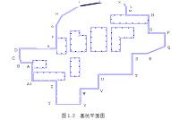
第二章:工程概况 8
2.1工程范围 8
2.2主要技术指标 9
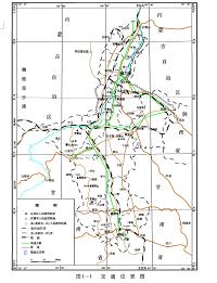
2.3工程建设地点及环境特征 9
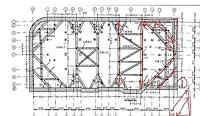
第三章:工程测量技术在路基工程中的应用 11
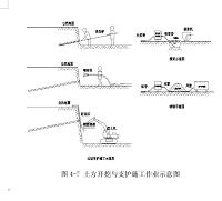
3.1施工技术准备 11
第四章:工程测量技术在桥涵工程中的应用 14
4.1施工技术准备 14
1.2桥梁控制网的精度确定 15
1.3桥梁控制网的坐标系统 16
1.4桥梁平面控制网的加密与复测 16
第五章:高速公路中的测量技术 17
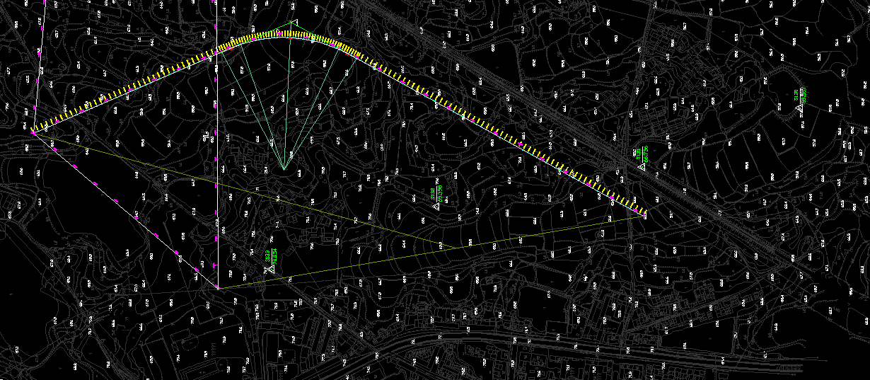
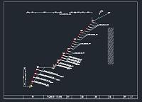
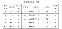
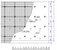
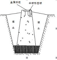
5.1 工程放样 17
5.2 准备工作 19
5.3 极坐标法放点 20
5.4 误差处理 20
5.5 复测工作 22
第六章:软件应用 23
6.1 fx5800编程计算器 23
6.2 AutoCAD快捷键 27
6.3 华测道路放样(RoadStak) 29
第七章:结论与展望 36
参考文献 38
参考文献
[1] 刘学,张弘.工程测量[M] .海南:海南出版社.2007.
[2] 杨国清.控制测量学.郑州:黄河水利出版社.2005.
[3] 赵文亮.地形测量.郑州:黄河水利出版社.2005.
[4] 卜艳萍.施工测量放样作业指导书[J].东北测绘,1998.
[5] 张正禄.工程测量学[M].武昌:武汉大学出版社,2002.
[6] 覃辉.土木工程测量.上海:同济大学出版社,2004..
[7] 王毅明,钟金宁,黄志洲等.GPS-RTK测量技术的应用与体会[J].现代测绘,2003(02): 28~29.
[8] 孔祥元,梅是义.控制测量学. 武汉:武汉科技大学出版社.1996.
[9] 徐绍铨,吴租仰.大地测量学.武汉:武汉科技大学出版社.1996.
[10] 李仕东,工程测量.人民交通绘出版社.2002.
[11] 合肥工业大学,重庆建筑大学,天津大学,哈尔滨建筑大学.测量学[M].第四版.北京: 中国建筑工业出版社,1995.
[12] 王昆杰.卫星大地测量学.北京测绘出版社.1989.
[13] 周建郑.GPS定位原理与技术.郑州:黄河水利出版社.2005.7.
[14] 吴来瑞,邓学才.建筑施工测量手册[M] .北京:中国建筑工业出版社,2005
[15] 工程测量规范[GB50026-2007]
http://www.bysj1.com/html/5839.html
http://www.bysj1.com/html/6302.html